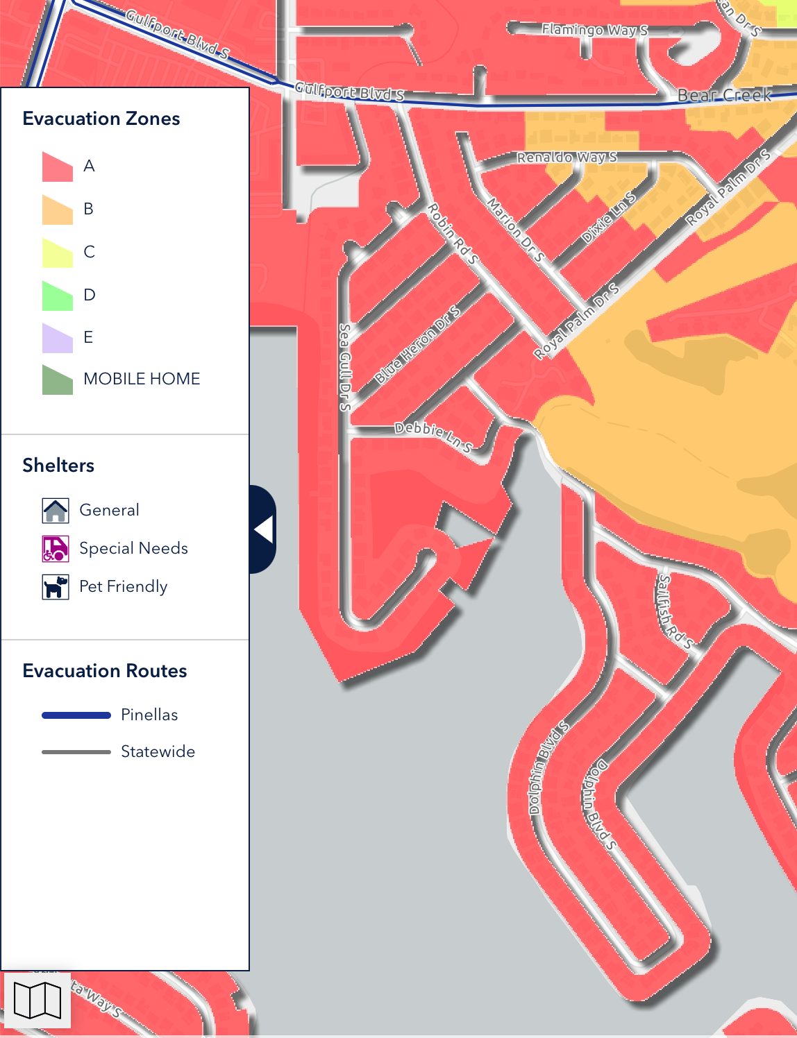
Storm surge is not the same thing as your evacuation level, even though the two mapping tools can look similar. While hurricane evacuation zones are based on storm surge, they also consider other public safety factors such as being cut off from first responder support. For example, properties on barrier islands that are connected to the mainland by a bridge are all considered to be in a Level A evacuation due to the risk to the bridge and to citizens being isolated, even if the application doesn’t show any storm surge on the parcel for that evacuation level.