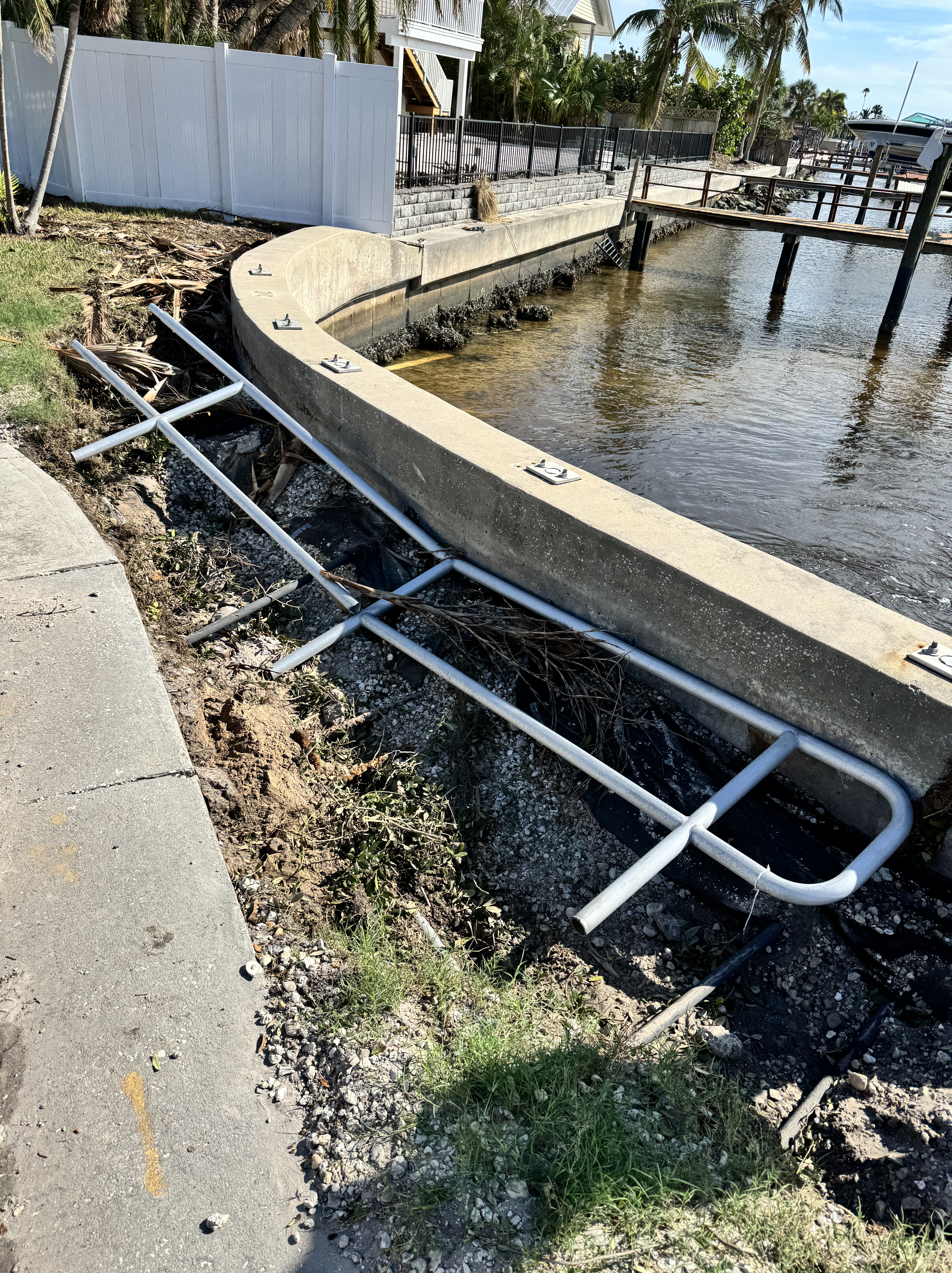
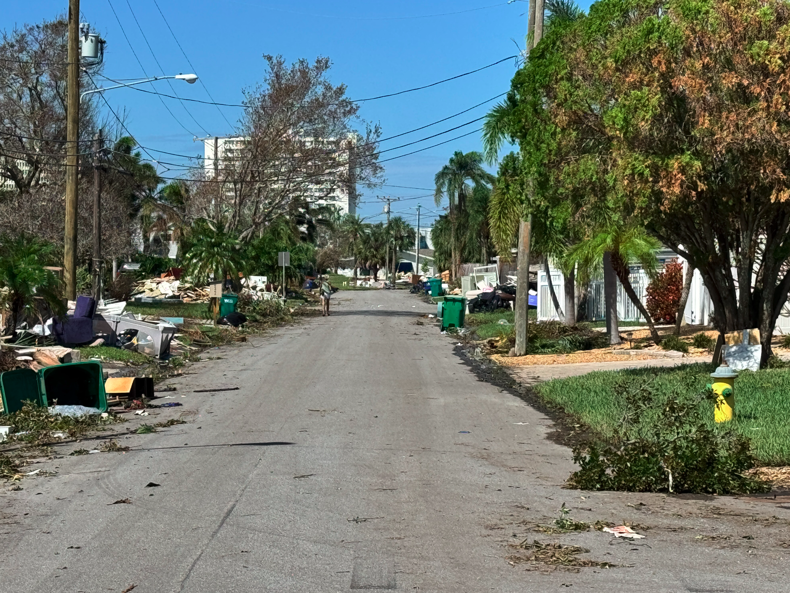
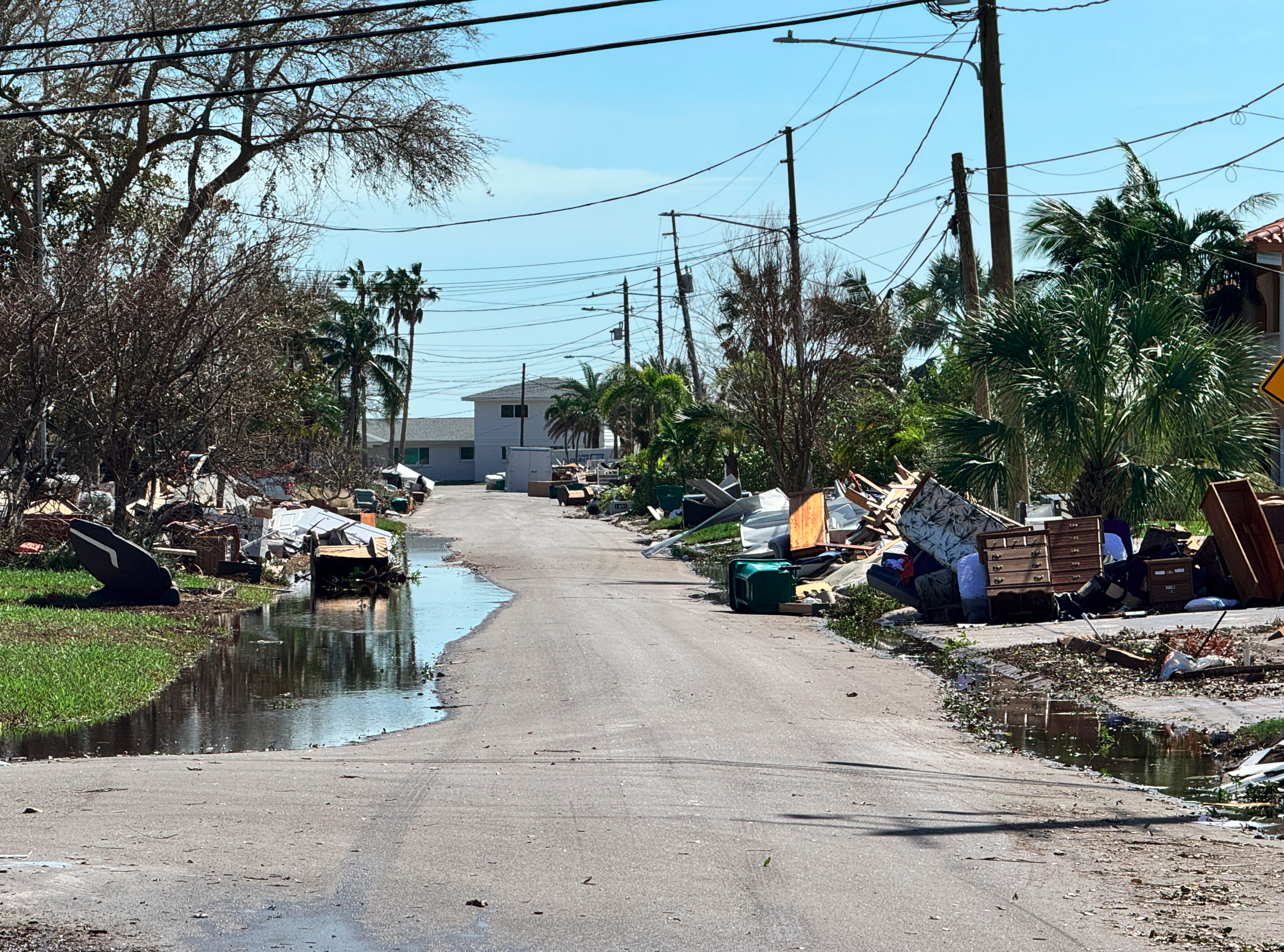
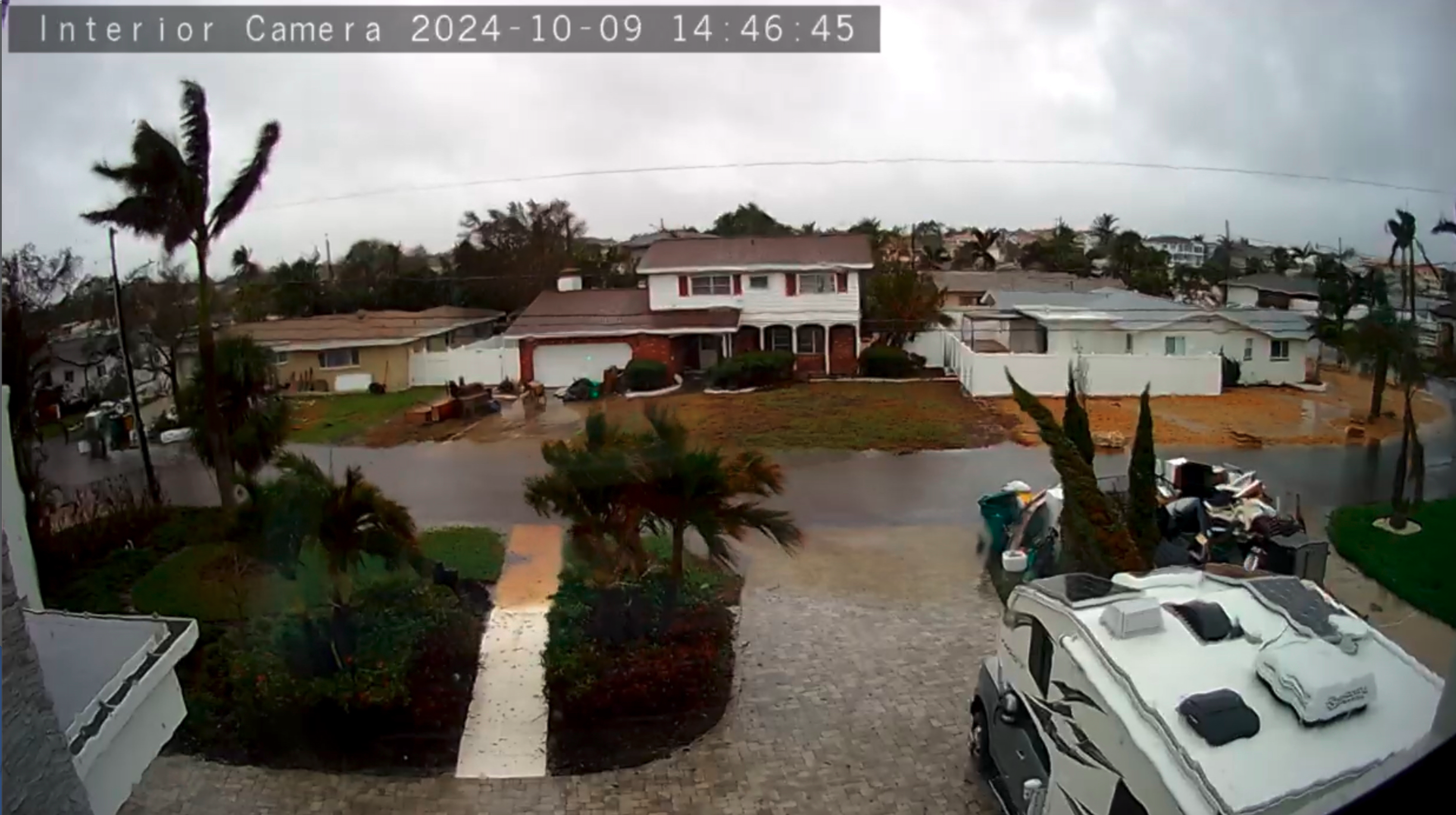
4:00 p.m. Bridge update from Scott Steiss
Scott inspected the bridge this afternoon and reports:
“Talking to Pinellas County, the bridge is open for one lane of traffic. Tell everyone to go slow and use caution. Travel their road at their own risk. The road is washing out from underneath. People should plan on the road being closed in the future.”
(photos by Scott Steiss, click on image to expand)


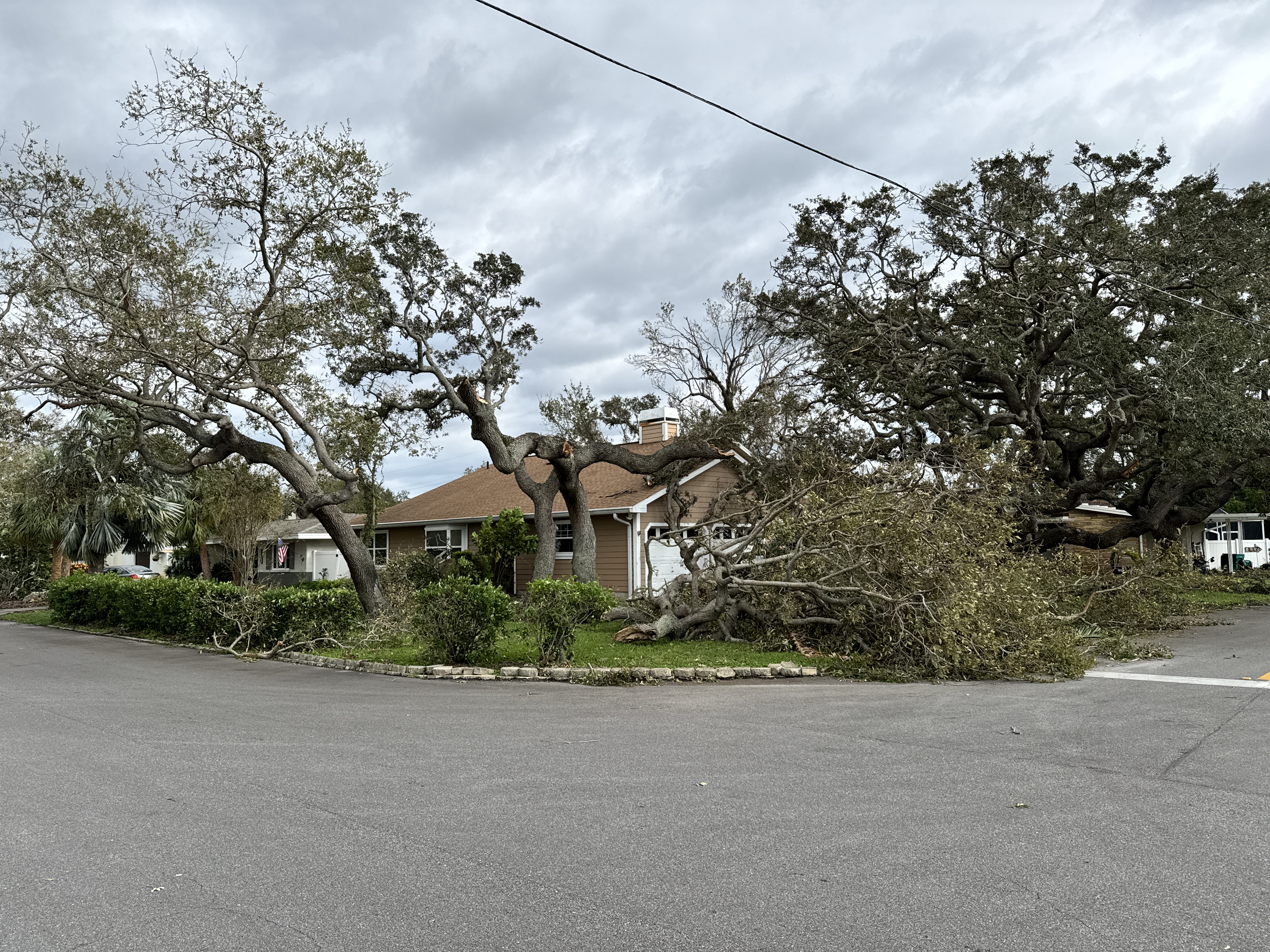
4:00 p.m. Marion at Augusta blocked
As far as we know Marion at Augusta is the only blocked street in our neighborhood (keeping in mind we have no images yet from the fish streets.
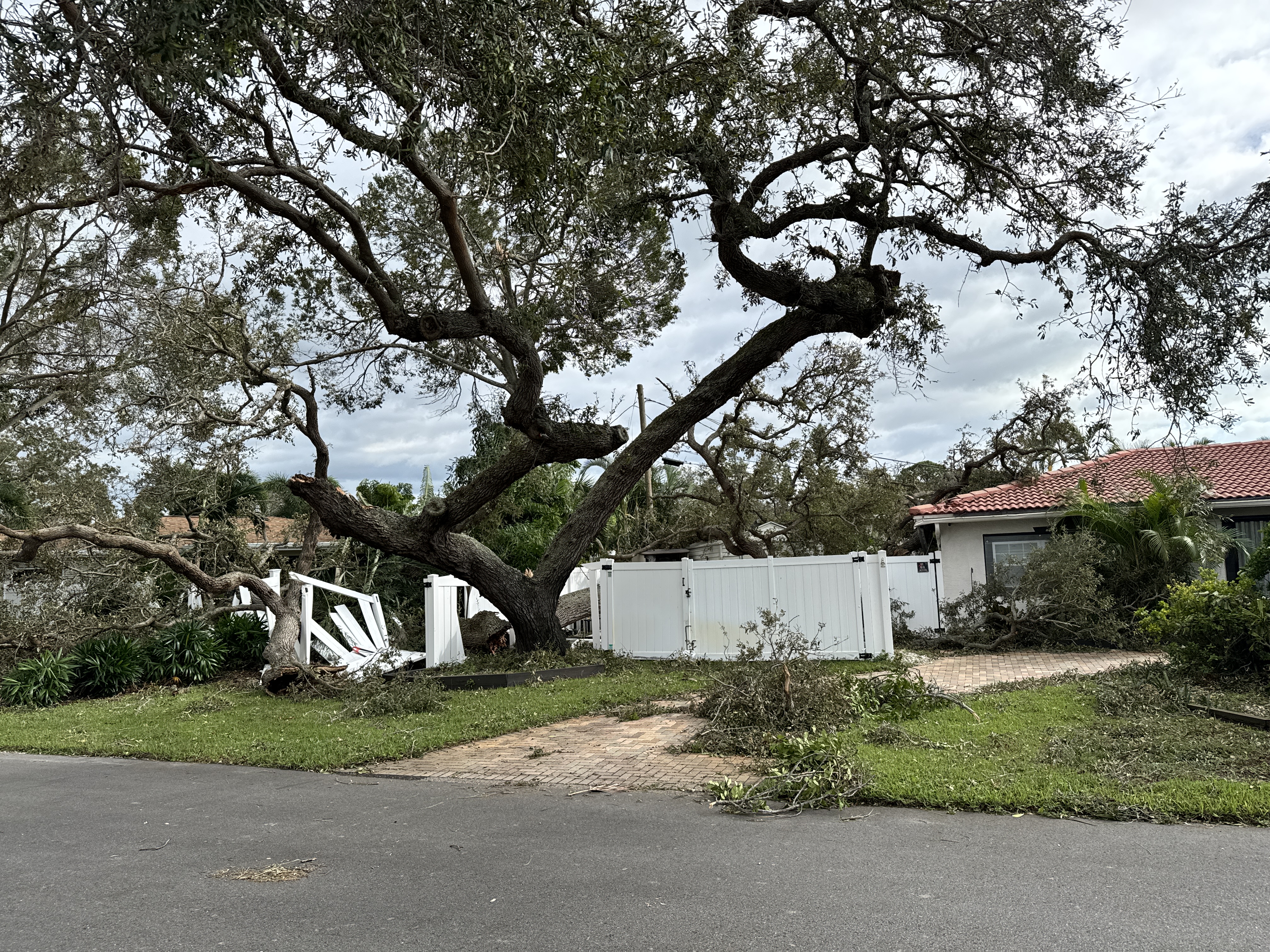
This is 1300 Marion
This is Marion at Dixie Lane

6610 Ronaldo
Corner of Ronaldo and Royal Palm

Royal Palm facing Robin
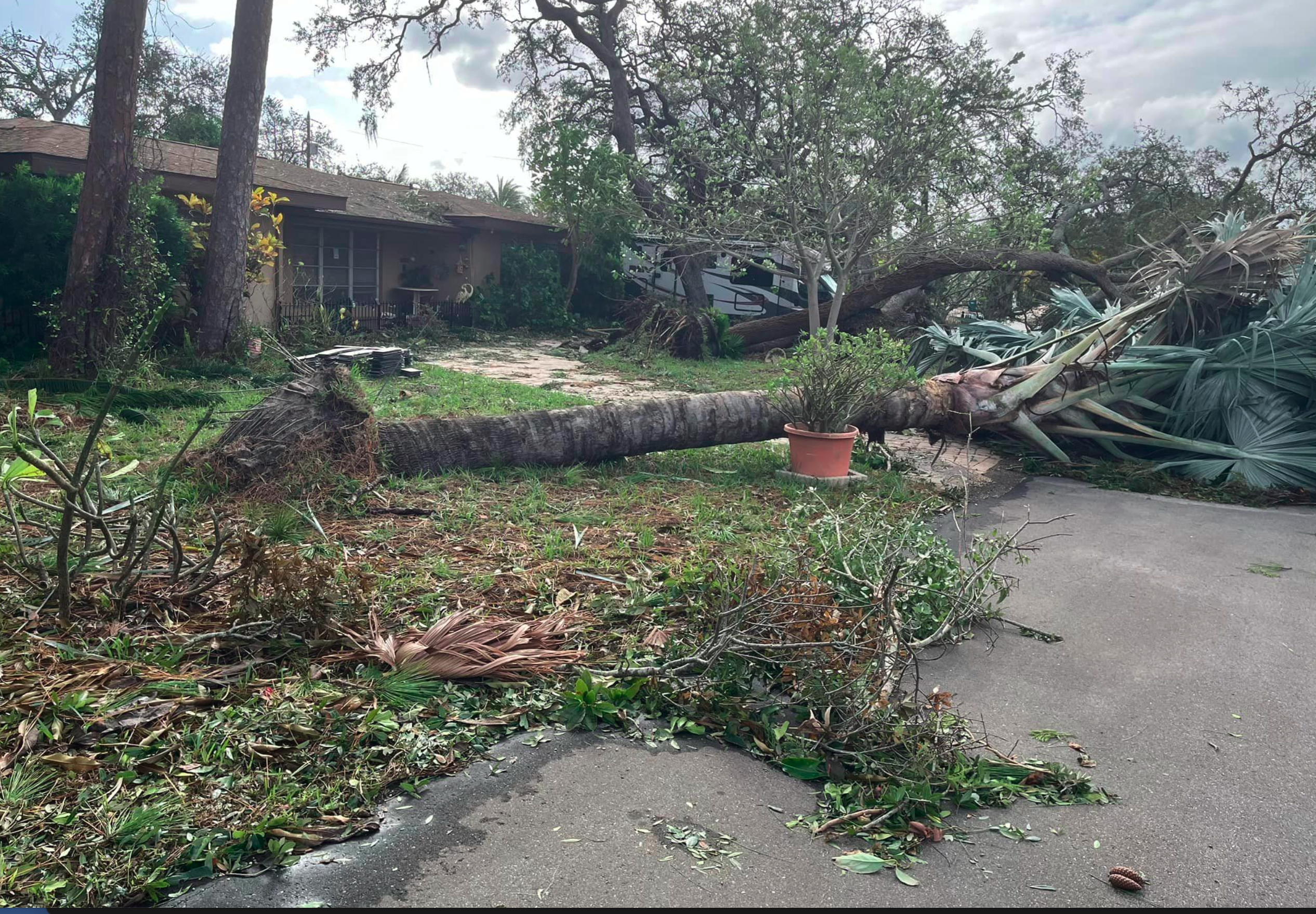
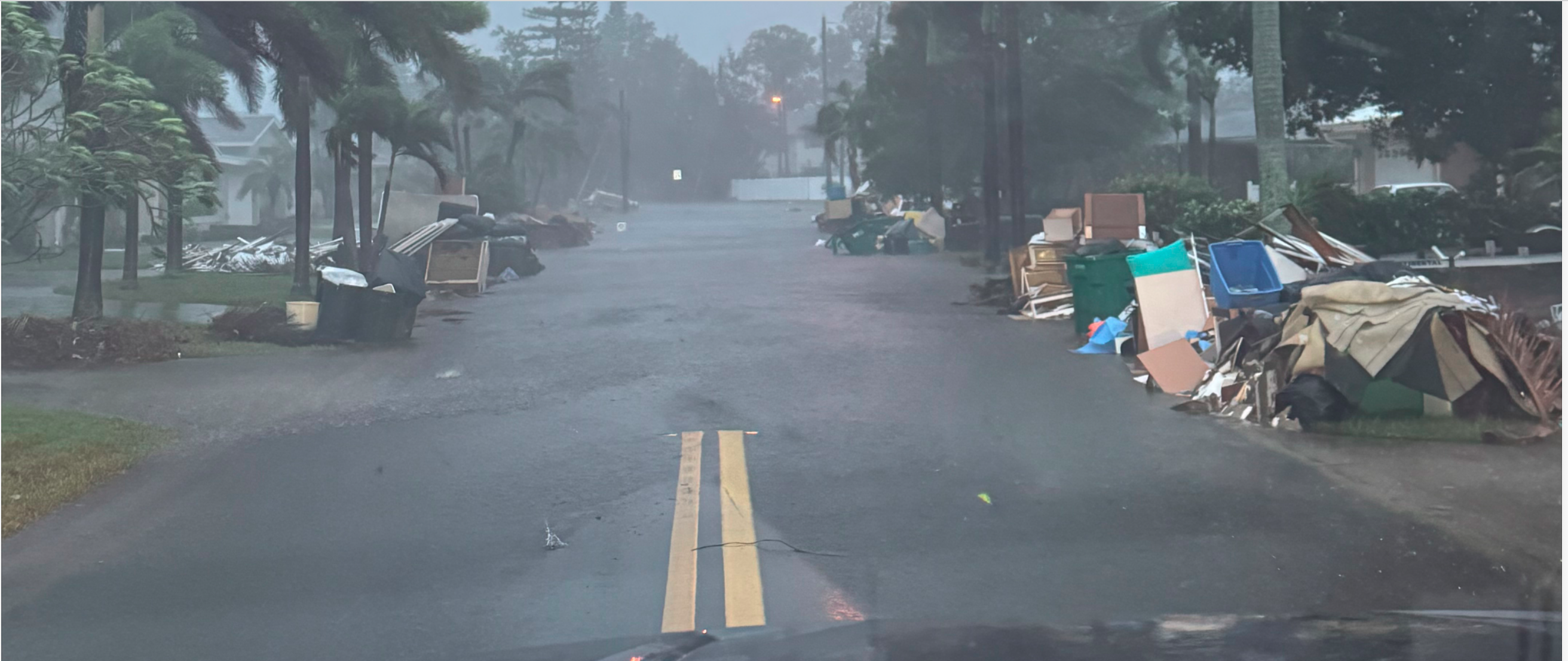
3:10 Amazingly, the debris piles seemed to mostly stay in place. One of the big concerns before the storm is whether the debris from Helene would become missiles. And from all we can understand from eyewitnesses in the neighborhood, the debris piles mostly seemed to stay put. The theory is that all of the rain that arrived before the high winds weighed down the trash piles.
3:05 TPA airport opens 8 a.m. Friday
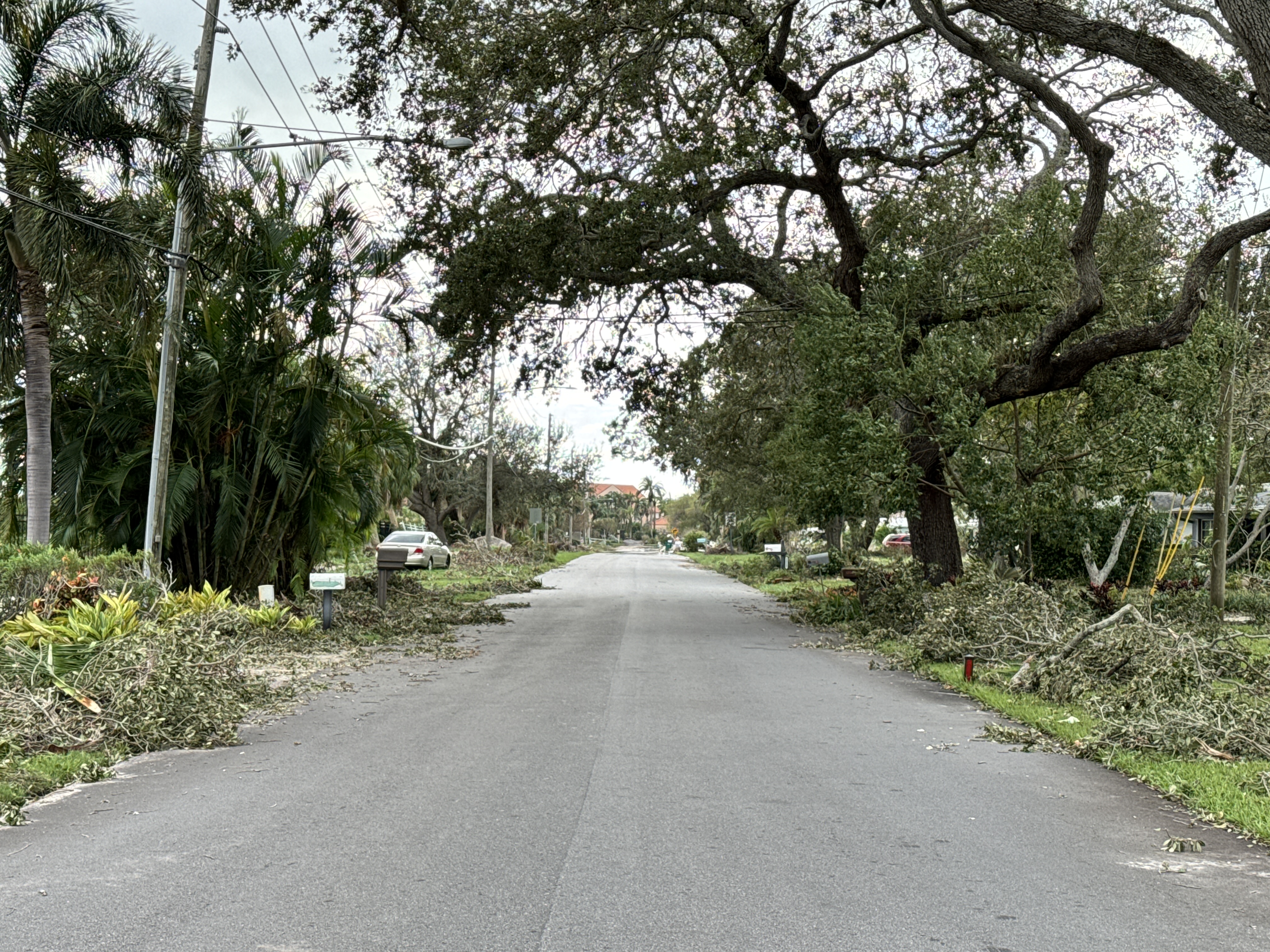
2:55 p.m. Cardinal Drive (looking from Seagull) Photos by Scott Steiss
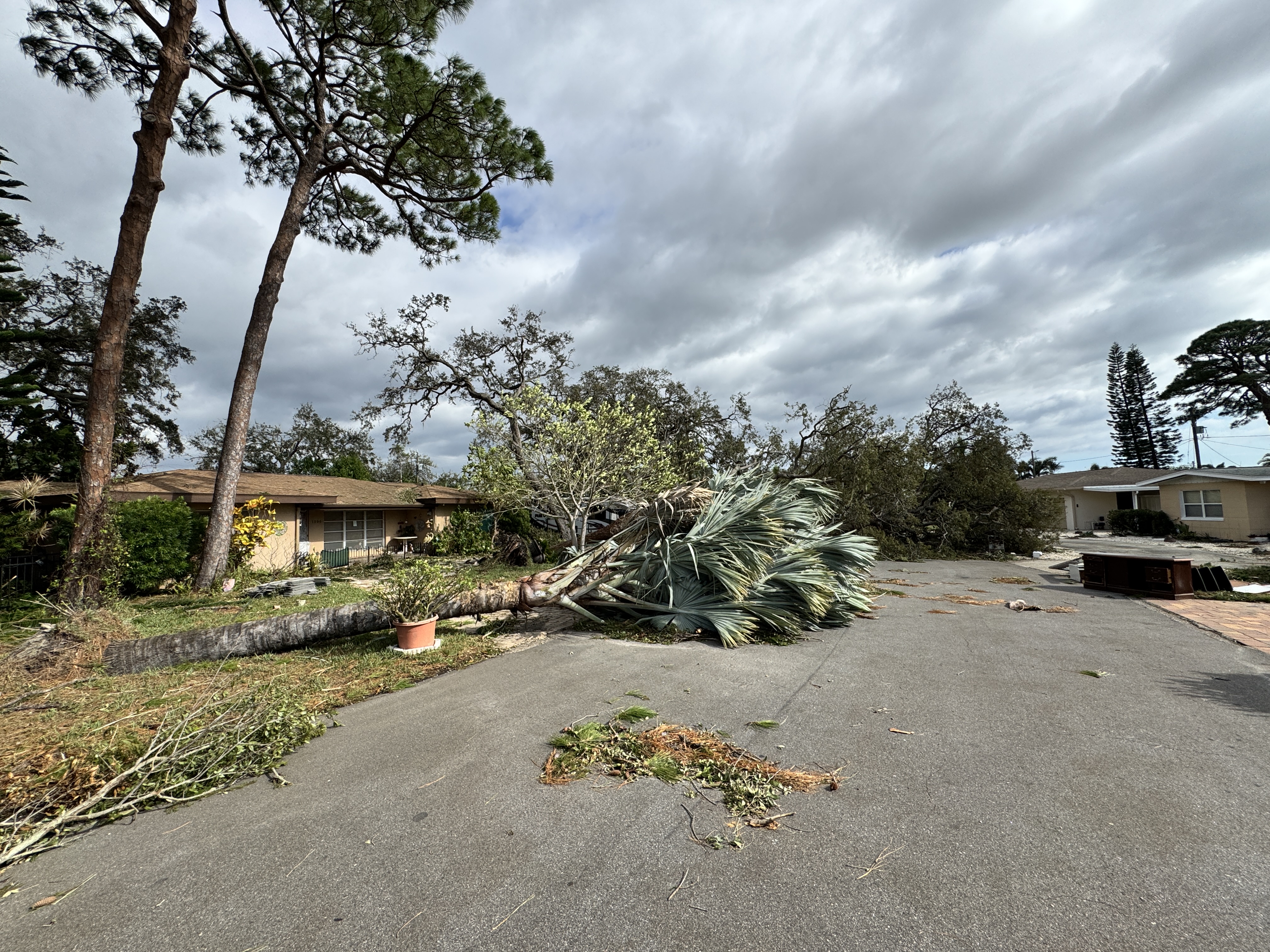
12:00 noon first images from Royal Palm, Ronaldo, Marion, Augusta (photos from Marialis Laly Kirk)
Tree on house on Robin

Tree on the road on Augusta

Royal Palm

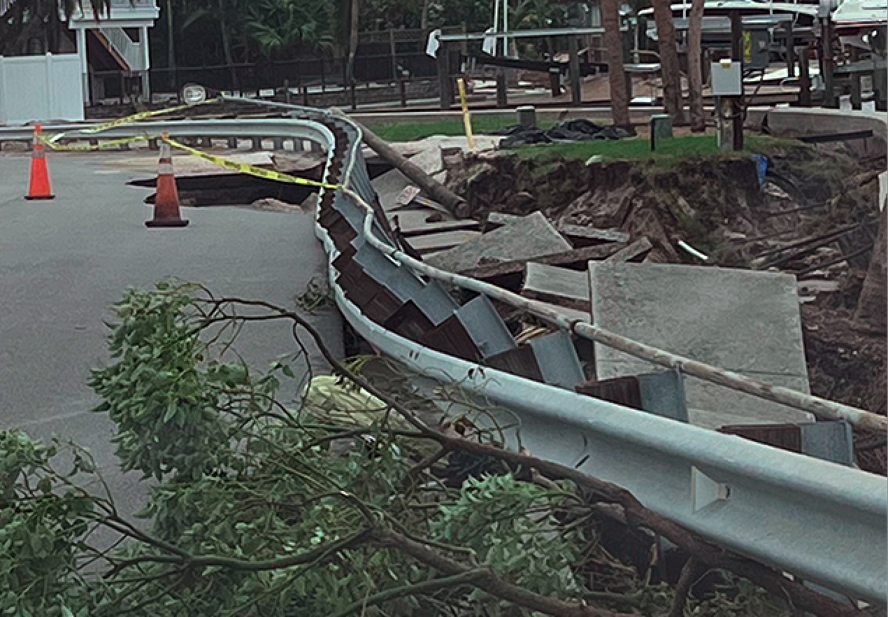
10:16 a.m. First images of Dolphin Bridge (by Ryan Farmer)
Ryan said the bridge is severely compromised. He saw a fire truck drive over it to place cones on the bridge and said he could see the bridge move under the weight of the truck.
Ryan said power lines and poles are down all over. Debris is blocking our streets. He said if you try to drive on the streets you risk puncturing your tires. He said he already picked a sharp object out of a tire. He said he has not seen any houses hit by trees.

There is standing water at the end of Sea Gull and a power pole in the middle of the road. Ryan said it is clear the power outage will be lengthy because it will require rebuilding some lines in the neighborhood.


10:06 a.m. 74% of Pinellas County is without electricity at this moment. (Source: Duke)
10:02 a.m. Grandy bridge is open. (Howard Franklin and Skyway opened earlier this morning.) Courtney Campbell is still closed.
9:34 a.m. Ryan Farmer, our neighbor, is in the neighborhood and says “The Dolphin Bridge is on the verge of collapse.” We are trying to get photos, stand by.
9:22 a.m. the Publix website says the store nearest to our neighborhood plans to reopen at noon today. (Be skeptical of this until we can confirm in person)


9:02 a.m. The Pinellas Sheriff’s office says Pinellas County is now OPEN
Early this morning, the county officials closed access to the county to inspect what hazards existed, but now the road coming into the county have REOPENED. Barrier island access is also OPEN. However, if you can stay away, do so because there is so much debris on roads.
9:00 a.m. important update from an eyewitness Ryan Farmer, a neighbor, is on the ground in the neighborhood. He reports:
The Dolphin bridge is compromised. It is blocked off. You cannot drive across the bridge. He could not get close enough to see if it partially collapsed or if the street was damaged. Do not try to come into the neighborhood. There is debris all over the streets, powerlines are down, many streets are impassible with limbs and debris. He says there was no surge on Dolphin.
8:36 a.m. Howard Franklin is open, Skyway is still closed but should open soon (source: Governor DeSantis news conference.)
8:19 first photos from the neighborhood
Robin and Cardinal

Robin and Mockingbird-facing Robin

8:00 a.m. (Thursday) if you come to a traffic light with no signal, treat it as a four-way stop.
1:12 a.m. GULFPORT says it TOO will shut off water
By the time you read this, Gulfport will have turned off water supplies to our neighborhood.
If you are evacuated, consider whether it would be better to stay away until Friday.
If you are determined to return Thursday, consider whether you can pick up water supplies where you are and bring them home with you. If you can find big containers such as gas cans, fill them rather than buying a zillion water bottles. You can find water in your water heater, but remember to fill the heater before you turn it back on. To drain a water heater just lift the drain valve at the bottom. With all of the rain we have had, you may find that you have big collections of water you can harvest around your house, in empty flower pots, bird baths, who knows. It may not be clean but you can fill a toilet tank with it. Generally, it does not take a long time to fix a water main break, but it may take a while to get the water tested.
The City of Gulfport announced:

11:55 City of St. Petersburg shutting down water to nearly all of the city
BayNews 9 reports:
The City of St. Petersburg is responding to a major water main break that will impact potable water services across the entire city.
The city is shutting off potable (drinking) water service citywide beginning at midnight on Oct. 9.
Residents and businesses should prepare for this temporary shutdown, which is expected to last until the necessary repairs can be completed. Repairs will begin once it is safe for crews to be outside.
Affected areas may already be experiencing low water pressure or service interruptions.
The city is issuing a boil water notice for all potable water used for drinking, cooking, and brushing teeth until further notice. Once the system is restored, further testing will be conducted to ensure water safety before lifting the boil water notice.
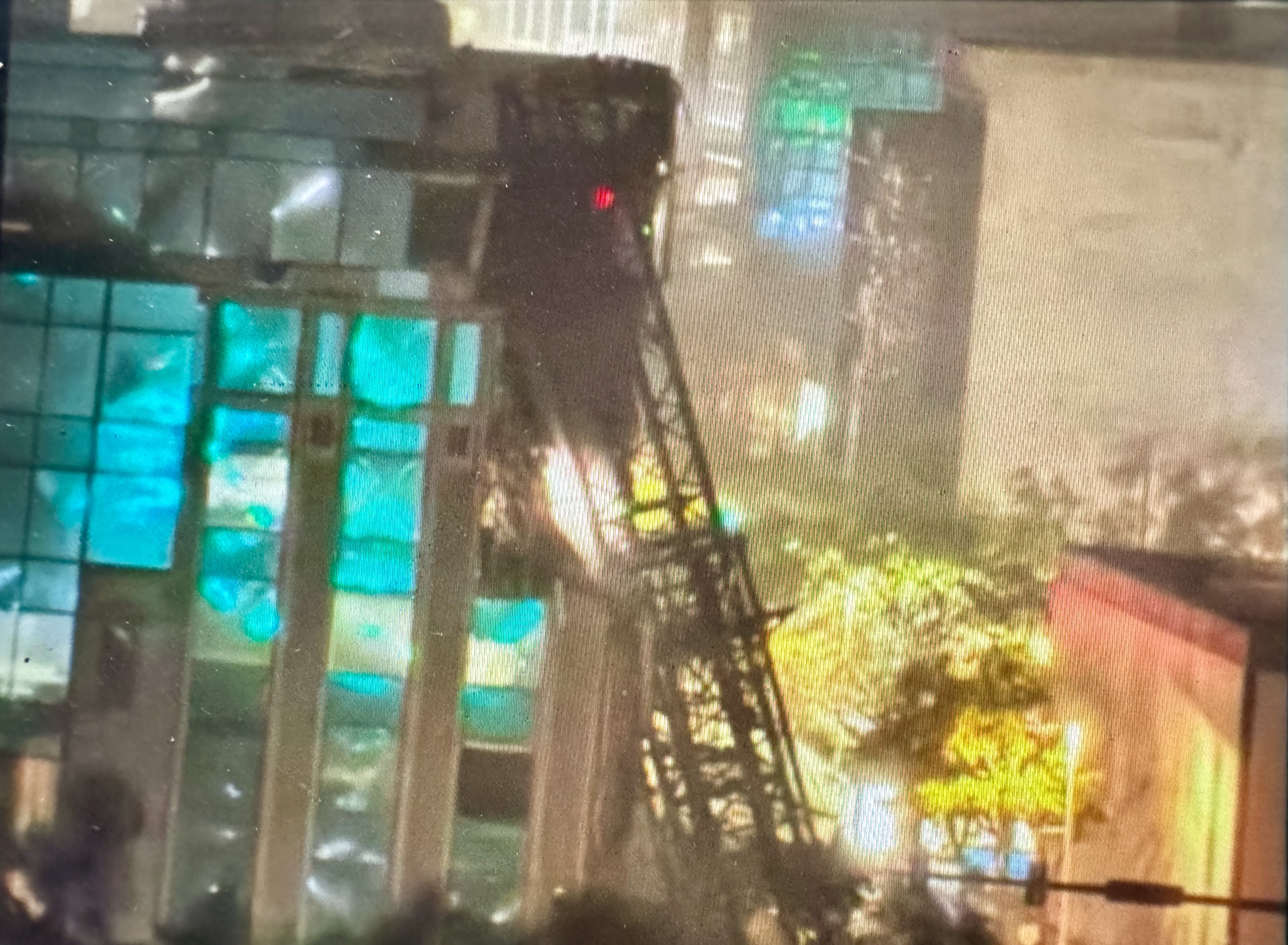
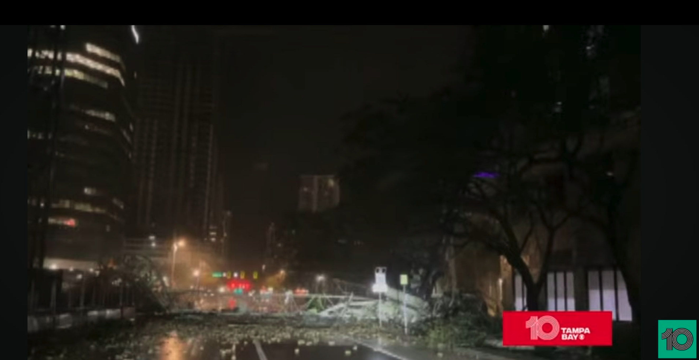
11:46 p.m. Sky crane collapsed in downtown St. Petersburg
City officials feared it might happen, and late Wednesday night one of the two large sky cranes used in building the newest downtown skyscraper collapsed in Milton’s wind. City officials said nobody was hurt in the collapse. Earlier, they explained that it can take weeks to deconstruct a crane of that size because it requires so much planning.
One of the cranes is reported to have hit the building that houses The Tampa Bay Times. (source Bay News 9)
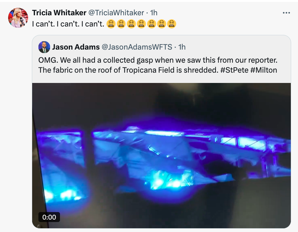
11:17 p.m. (with update at 12:40 a.m.) Roof of Tropicana Field ripped to shreds– click on images for video
Eyewitnesses say the stadium roof is in tatters, waiving in the wind. The Trop was hosting hundreds of lineworkers who came to St. Pete to repair power lines. However, Tricia Whitaker, the field reporter for the Rays, reported that there were no first responders still staged at the Trop when the roof blew away. The fabric roof was reported to be able to withstand 120 mph winds.

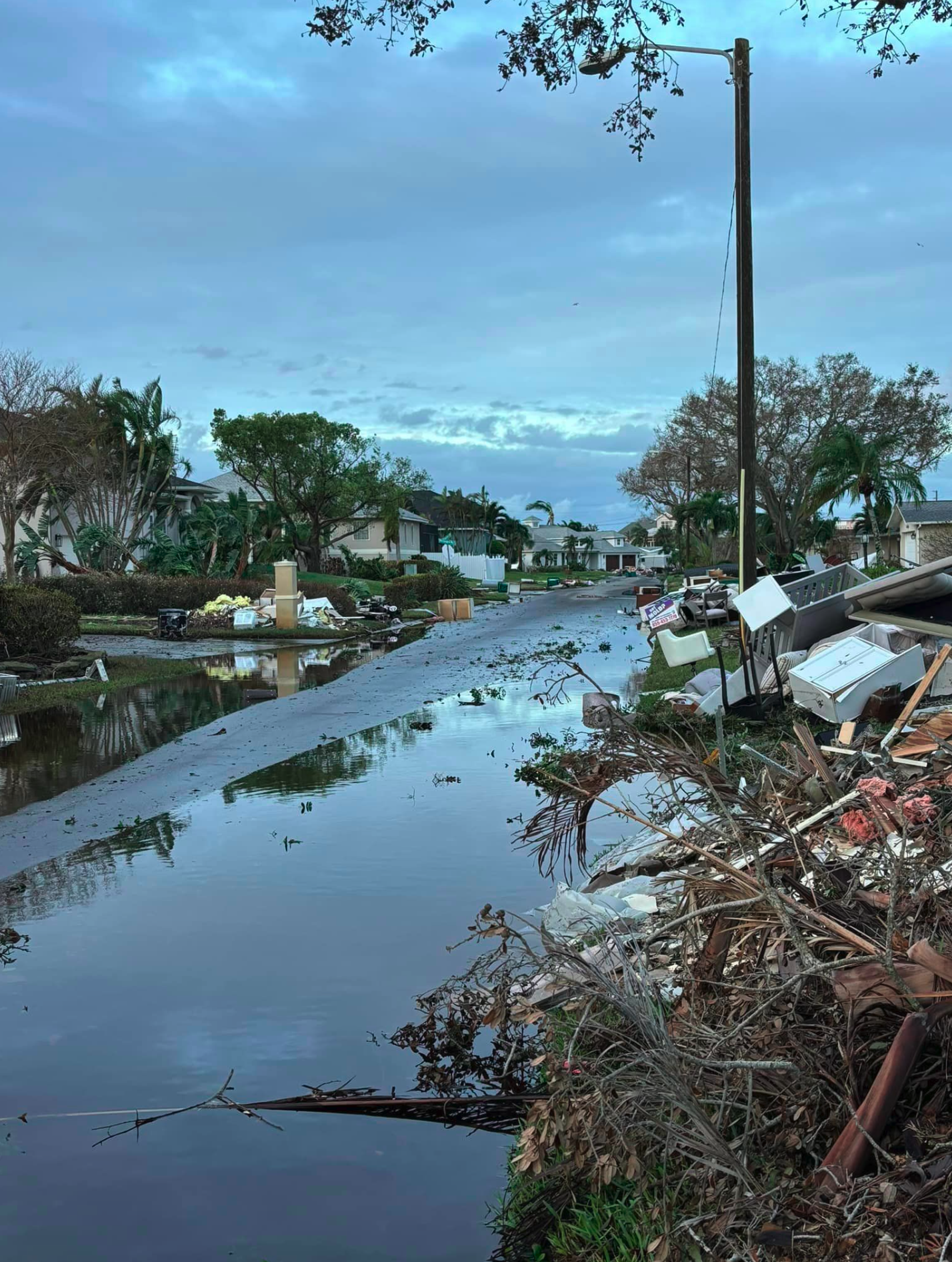
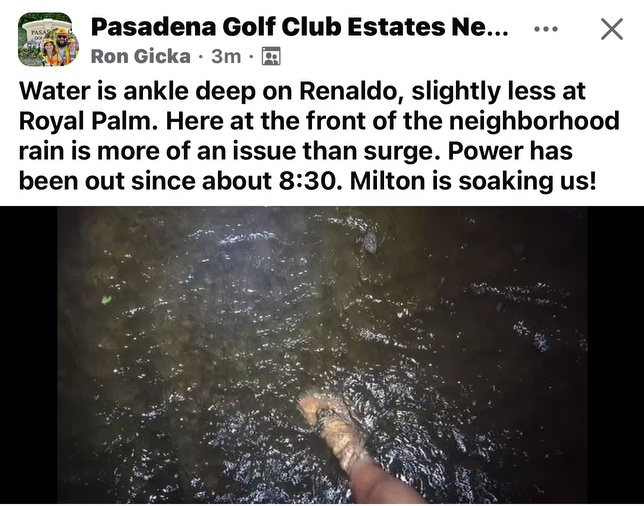
10:30 p.m. New video of flooding on Renaldo/Royal Palm
He lives in the newly constructed big blue house at the corner.
10:04 p.m. St Petersburg airport says 16 inches of rain have fallen in St. Petersburg today.
Five inches fell in one hour.
8:45 p.m. our entire neighborhood has lost power
The Duke map shows everything is dark now. Duke says 40 states are sending help to Florida. 285,000 Duke customers have lost power.

8:33 p.m. Landfall Siesta Key
Hurricane Milton has landed and the target is Siesta Key, Florida.
8:20 p.m. We are on the “backside” of the storm, where wind and rain pick up
The heaviest storm and wind for our neighborhood are underway. They are nit hurricane winds, but they are driving drenching rain.
8:11 p.m. Extremely heavy rain in our neighborhood now
While we escaped the surge and hurricane wind our neighborhood is currently being pounded by very heavy rain. The rain occurring now is what is called “the whipping effect” which is the heaviest rain of this storm for St. Pete.
It may well still happen that while we are not lined up for the surge or wind we fared, the extremely heavy rain can still cause considerable problems considering the drainage problems we experienced in recent weeks. For some places, the accumulation may be a foot of rain from this storm. However, the winds may pull the water from the bay quickly.
Plus we have a lot of debris that could wash around. The storm is moving faster than expected, so the worst should be over around midnight. Hang tight.

8:01 p.m. Water levels (tide) are dropping at Clearwater monitoring station

7:31 p.m. spotty power outages in our neighborhood

7:26 the center of Hurricane Milton zeroes in on Sarasota
The Bay News 9 anchor’s hand is where the eye will land.

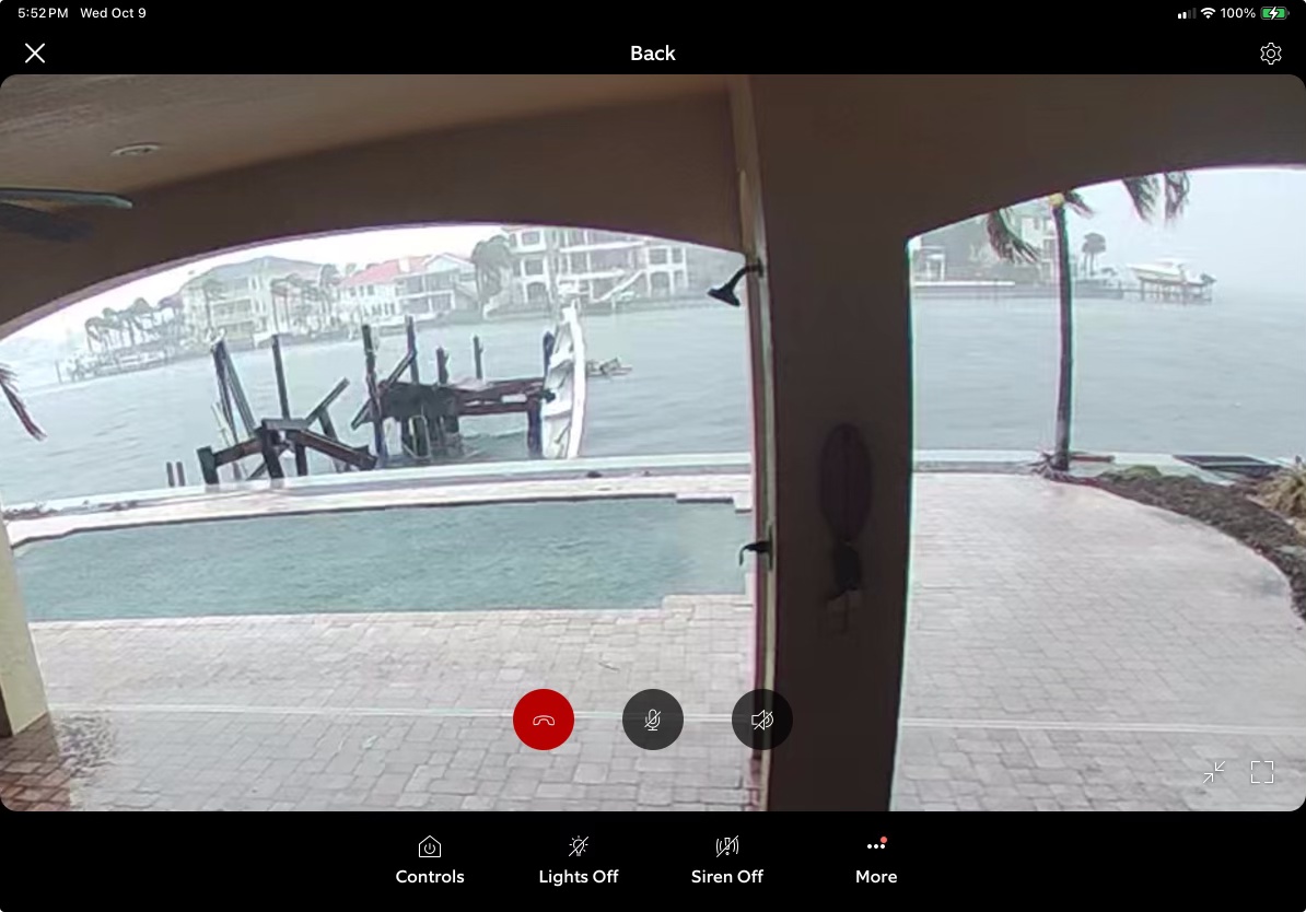
7:01 p.m. First image from Dolphin and Mockingbird
The camera has captured a fair amount of debris washing down the street but not overwhelming flooding.

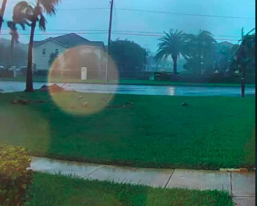
6:40 p.m. First images from Robin Road and Royal Palm
You are looking from the entrance of Robin Road toward Royal Palm. As you know this was one of the real problem spots during Helene when the drain at the end of the street was overwhelmed while the drain on Pasadena Avenue was pouring water out of Bear Creek into our neighborhood. This image shows while there is some flooding, it is a long way from what we saw in Helene. We are not out of the woods, but it is encouraging that we do not have a flood at this point in the ordeal. A million thanks to Jamie Burge for the image.
The next image is of Royal Palm Drive. It is from the Ring camera on the first house on Royal Palm as you turn from Pasadena Ave (22nd north.) (image from Donnette Romero)
The image shows no apparent flooding that we saw in that big downpour a few weeks ago.
6:33 p.m. St. Pete to shut down two water-sewer plants but it does NOT affect our neighborhood
You are going to hear media say that there are some water and sewer services being cut off. I want you to understand we in our neighborhood are NOT affected. The city of St. Petersburg has announced it will shut off both the NORTHEAST and SOUTHWEST sewage treatment plants to protect employees and equipment from Hurricane Milton’s “potential storm surge.”
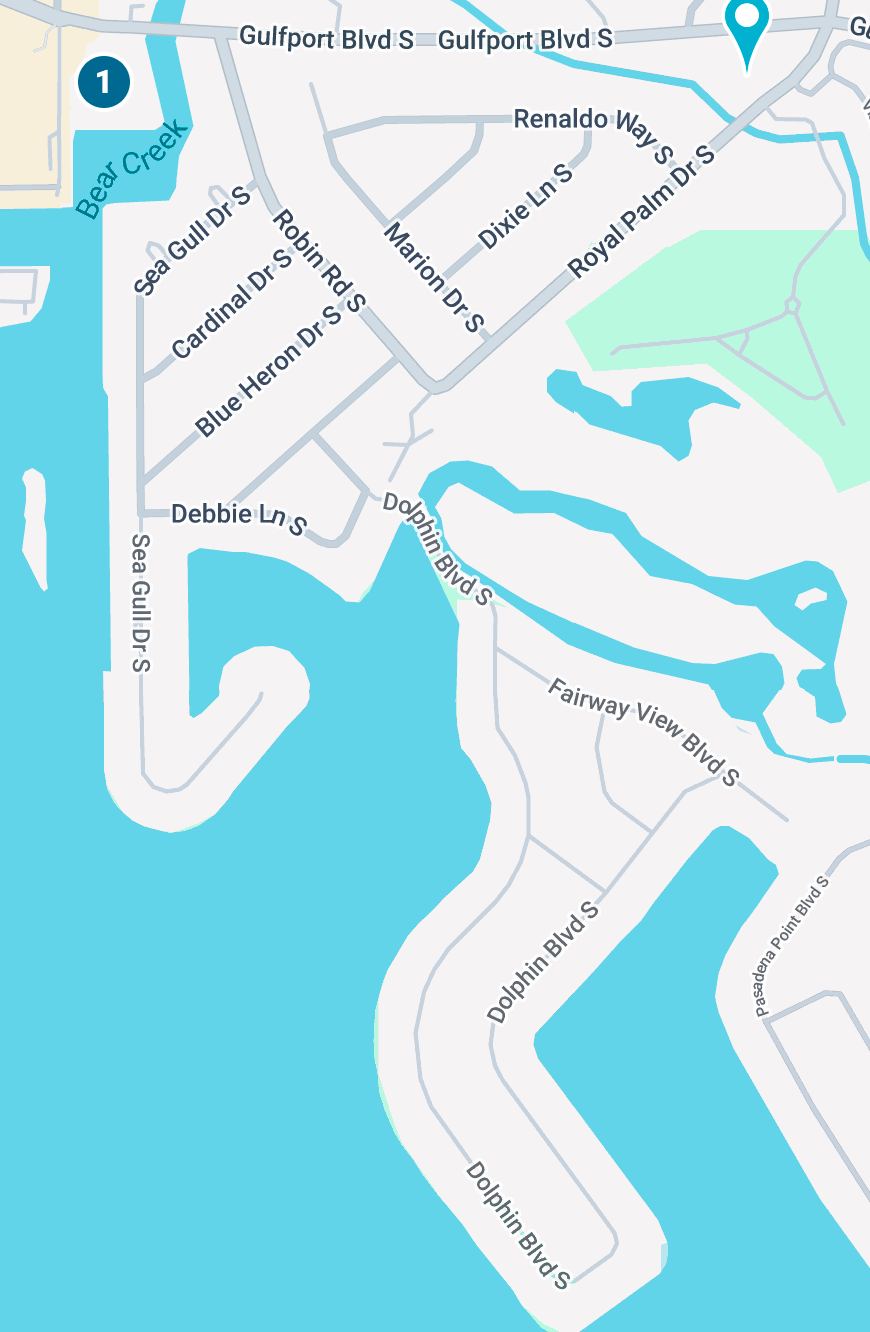
This map shows what neighborhoods are affected by those plants. As you can see, it is not us.

5:31 p.m. Updated photo from 1972 Dolphin, Marion and
Not much change since 2 p.m. with moderate street flooding
Thanks to Lynda Velanovich for the image

Marialis Laly Kirk on Marion posted this image at 5:31 p.m.
This location had several inches of water during Helene and so far, nothing. Thanks Marialis.

5:53 2016 Dolphin Blvd S. water still below wall, not much change since 2 p.m.

5:32 p.m. End of Dolphin Blvd- Steve Weiss reports the water is still below the wall
5 p.m. Landfall moved up now 9 p.m. to midnight
When the eye comes on shore, your phones will ring with an “extreme wind warning” which is nothing new to you by now. Just wanted you to know to expect that around 9 or 10 o’clock.
4:50 p.m. water is temporarily pulled out of Tampa Bay
This is a temporary situation, but you are looking at a camera shot of the Howard Franklin Bridge right at the exit to the Tampa airport (heading toward Tampa.) I have highlighted the area that is usually covered with water and at this minute is not.
This won’t be like previous storms where a huge amount of water was sucked out of Tampa Bay.

4:40 p.m. 53,000 emergency powerline workers are ready to respond to power outages
The state EMS says it expects millions of Floridians will be without power soon and the state is staging the biggest response in state history. 53,000 lineworkers and other specialists are in Florida or on the way. At this moment, Duke Energy is reporting small outages

4:37 p.m. Over 50 Tornado warnings in southeast Florida–responders on the move
Significant damage in St. Lucie County according to state EMS director Kevin Guthrie.
State EMS says it is starting to move responder caravans south since the storm is clearly going to be centered further sound. The state is moving high water trucks, swift-water rescue and structural collapse teams closer to the storm center. They were located near Lake City, then will move to Ocala by 5:30 and then will move further south around sunset tonight.
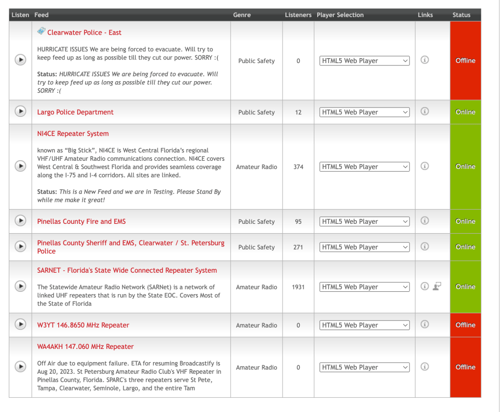
Listen to live Pinellas EMS, Police, Fire/Rescue
Click on the graphic below, when you see the map, click on Pinellas County. Scroll down to “Listen.” It will open a second window. You will get a 30-second commercial then it will play scanner audio non-stop.
4:08 water on Dolphin appears to be rain runoff not salt water from a surge

4:03 Milton degrades to Category 3
The storm is now 125 miles per hour, which is exactly what was forecast
4:01 p.m. Urgently waiting for an eastern turn
The storm is expected to make a turn east, which would put the highest surge and strongest winds around Sarasota. But at the moment it is moving northwest which puts the center at the north end of the cone at the bottom of Tampa Bay. In short, the danger for us is FAR from over.
4 p.m. no power outages reported in our neighborhood yet.
3:50 AT&T waives overage costs
AT&T is waiving overage charges to provide unlimited talk, text and data for postpaid and prepaid customers with billing addresses in zip codes across affected areas from Oct. 9 through Nov. 7.
3:32 wind speed in St. Petersburg is now 36mph– gusts to 45 mph
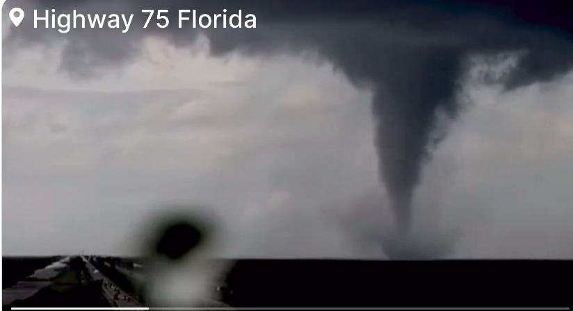
3:20 p.m. hurricane spawns tornadoes
Lake Placid is in the middle of the state. Think of it as a straight line east of Sarasota, ab out halfway between Lakeland and Allegator Alley. Tropical tornadoes usually form and evaporate fast and so far most have been in very rural sparsely populated areas of the state.

3:15 p.m. Deskins says landfall may be sooner than forecast:
Bobby Deskins-WTSP meterologist posted on Facebook:
I’m thinking landfall is much earlier than NHC forecast. NE eyewall arrives on Sarasota coast around 6-7pm, landfall 8-10pm? That means water levels coming up now and peaking before midnight
3 p.m. Water water starting to pool on Dolphin
Home security camera on Dolphin shows water pooling on the street and starting to edge up on driveway. (photo sent by Lynda Velanovich-1972 Dolphin
2:54 p.m.
Howard Franklin s now closed – Skyway closed earlier.
Those headed toward Hillsborough County can still cross the Gandy and Courtney Campbell.
2:04 p.m.
Live cameras around Tampa Bay
Clearwater Beach (4-in-one):
Clearwater Beach:
https://www.myclearwater.com/…/Watch-Live-Video-of…
Siesta Key Beach:
https://www.youtube.com/live/NLhxcyzXQxM?si=6YhkXHsoHVVXPbl4
St. Pete Downtown:
https://www.weatherbug.com/weather-camera/?cam=STPBL
Clearwater Beach Hilton:
https://www.fox13news.com/clearwater-beach-webcam
Sirata Beach Resort St. Pete Beach:
https://www.fox13news.com/st-pete-beach-webcam
1:16 first reports of roof damages in Ft. Myers – radar indicated tornado
1:10 p.m. What evacuees can expect in Orlando overnight
Many of our neighbors escaped to Orlando. But authorities say they should be alert to extreme rain and probable power outages in the early morning hours. If possible, move your cars out of ground-level parking to inside parking structures. The Weather Channel says fuel is plentiful at the moment. Some gas stations are closed.
1:08 p.m. Weather Channel report on max winds expected for our neighborhood
The Weather Channel reports that max winds for Pinellas now are expected to peak at 78-110 mph with the strongest winds now south of Pinellas and Hillsborough Counties.
Tampa and Orlando could both see overnight flooding tonight. “This is not just a costal issue for Florida.”
12:53 Skyway Bridge CLOSED- Gandy and Howard Franklin still open for now
Sunshine Skyway Bridge –The Sunshine Skyway Bridge closed. (source: Florida Highway Patrol)
The Howard Frankland and Gandy bridges are monitored by FHP. FDOT is notified when water is on the roads leading to the bridge. FDOT crews close these bridges when FHP deems it necessary for safety. Transportation officials anticipate this may become necessary by Wednesday afternoon.
Courtney Campbell Causeway – This bridge is monitored by the Tampa Police Department and the Clearwater Police Department. FDOT works with these agencies to close this bridge when the water gets close to the approaches and makes it dangerous to drive. Officials anticipate this Causeway may close by Wednesday afternoon.
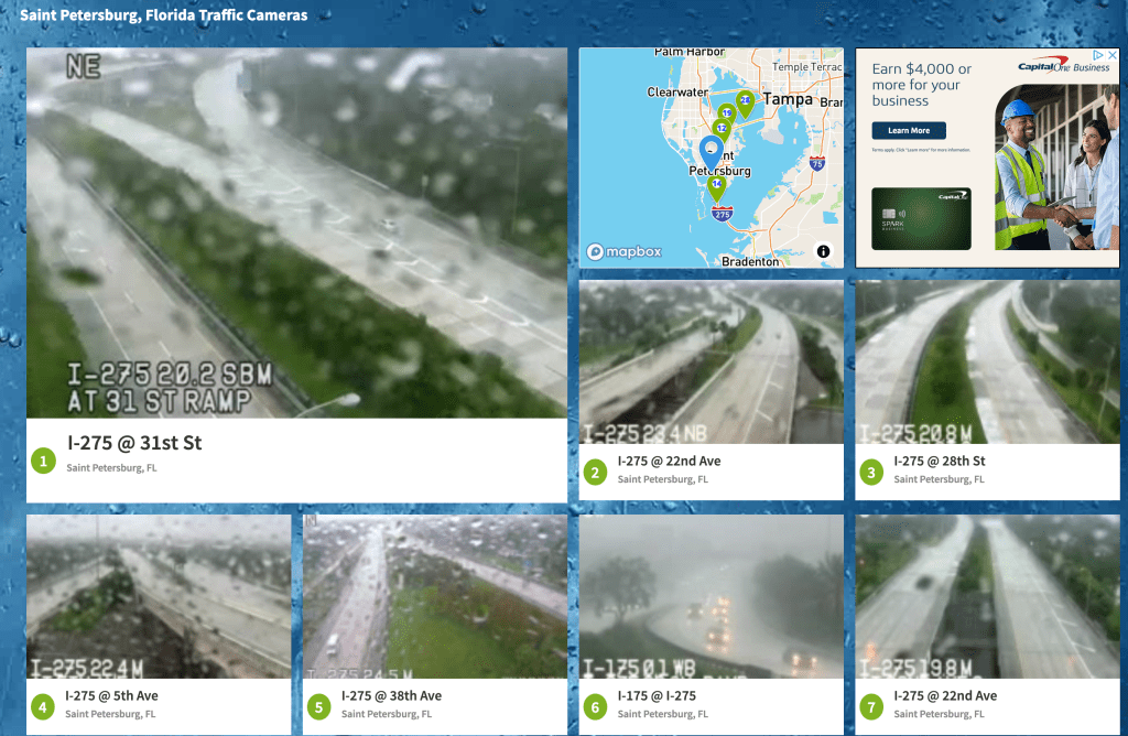
Live traffic cameras in Pinellas County
12:32 p.m. Wed
Hurricane spawns tornadoes inear Fort Lauderdale. Martin, Okeechobee counties both report tornadoes.
Wed Oct 9th 11 am conditions Update
Milton is lowering intensity, as expected.

Now at Cat 4. 145 mph wind
Landfall will most likely be between Anna Maria Island and Sarasota.
Likely to landfall as low-end Cat 3 (source Bay News 9)
St. Pete top surge 6-12 foot worst case scenario for surge (source Bay News 9)
There are tornado warnings, a tornado was reported near Allegator Alley.
30 mph winds in St. Pete now.
Heavy rain will pick up this afternoon.
Some power outages reported near Stetson and Gulfport.
Eyewitnesses said they say military Hummers and police cars rolling up 34th ave on patrol. (two sources)
Wednesday October 9th -Governor’s News conference
10:50a Wed: News conference update-important info
Governor DeSantis said in a news conference that there is “a lot of nonsense online about FEMA planning to keep people out of their homes after the storm.” He said it is nonsense being circulated by online rumor mongers trying to create website traffic.
DeSantis said emphatically, “The State of Florida is running this show.” He said his executive order is clear that Floridians have a right to return to their homes after the storm, which for us will be Thursday.
He said not to believe the online rumors about FEMA taking over emergency operations. He said the state, of course, will be using FEMA resources where it can.
Also, the State Highway Patrol said many states will be sending in out-of-state officers to help with post-storm security against looters and scammers. The FHP said officers will use what he gently called “intentional contact” to apprehend bad guys.
State officials said they would set a goal to get students back in schools within five days after a devastating storm.
It could be possible, officials said, that the state would use vacant big box stores in malls, for example, as recovery centers if schools cannot be occupied. Some children will be moved to different schools in some places. That will be done by county school districts. The governor said most schools not on barrier islands will be useable because they are built to hurricane standards (which is why schools are often evacuation centers.)
Low-connectivity news sites for people who have bad cell connections
If you have low connectivity for your phones-there are some low-bandwidth news sites that load text only fast.
I will be adding some local sites as they come online, but for now, here are some national news sites. This is not the best way to get storm info, but if you are a news junkie, it will keep you informed. Free, of course.
https://greycoder.com/a-list-of-text-only-new-sites/
Oct 9, 9:15a Listen to live fire/rescue/police/sheriff dispatch
Neighbors, if you want to listen to live Pinellas fire, dispatch, police then go here. As a lifelong journalist, let me give you a few guidelines as you listen.
Dispatch traffic is not confirmed. It is people calling into 9-1-1 and responders responding. So don’t let every incident call raise your blood pressure.
Let’s not share this link with a bunch of people or it will slow down connections.
Do NOT SHARE what you hear on police scanners. It is like sharing a rumor. If you do share something, be sure to timestamp it.
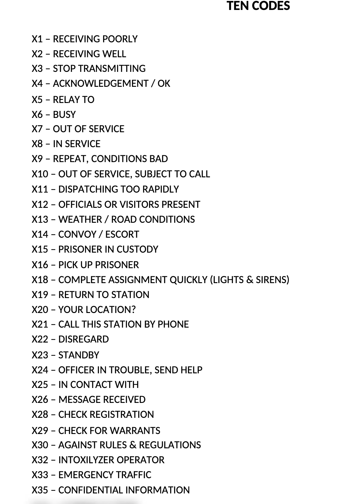
I am attaching the 10-code guide to help you understand police-speak on scanner communications.
Also, limit your intake of this stuff. No good news comes from 9-1-1 radio traffic so it can skew your attitude to thinking the world is constantly on fire.